Geospatial techniques
Tobler’s First Law of Geography states: “everything is related to everything else, but near things are more related than distant things”. This has never been more applicable than in today’s data-rich world, where reliance on digital geospatial data is found everywhere.

Spatial analysis is central to much of the research we undertake in the School of Geography and Planning. This includes the mapping of spatial inequality and patterns of digital engagement and remote observation of volcanic gases, global dust emissions, earthquakes and ice sheets.
Our facilities enable our graduates to gain theoretical understanding and practical experience of industry leading software and programming languages, equipping them with the crucial transferrable skills to capture, store, analyse and display geospatial data.
As a Geography BSc student, our expertise in geospatial techniques will benefit you throughout your degree.
Level 1
Our first-year undergraduates gain foundational training in finding, evaluating, analysing and presenting geospatial data and information (such as satellite images and spatial census data) using the Matlab programming language and ArcGIS – an industry-leading Geographical Information System (GIS).
As well as computer-based practicals, you'll also use geospatial equipment on local field trips, enabling you to learn technical skills, such as topographic surveying.
Level 2
As a second-year undergraduate, you'll develop geospatial skills by focussing on data processing, geo-statistics, GIS and Remote Sensing.
You'll use large geospatial datasets to study contemporary social and environmental processes, by tackling real-world topical problems, such as the siting of terrestrial wind farms in the UK.
Geospatial techniques will also be applied to data which you collect on an international residential fieldclass using a variety of field techniques and equipment.
Level 3
In your third year, you have the chance to use relevant field techniques and equipment, and apply your expertise in statistics, programming, remote observation and GIS to carry out independent research on your dissertation and optional field classes.
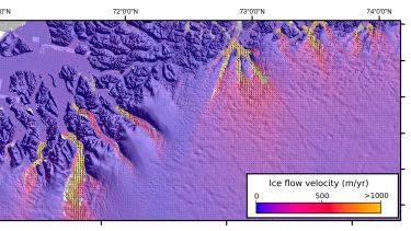
You may also choose to further specialise in Matlab, where you'll write computer code to analyse satellite images and meteorological time series, determine glacier flow, and Advanced Geospatial Techniques. You'll use targeted case studies and new technologies, such as drone-derived data, to make high-resolution topographic surfaces.
This pathway would provide ideal training for our MSc Geographic Information Systems.
